|
John L's Old Maps / Supplementary Pages: Views of the Apostle IslandsPage IV:
|
|
 See the MENU
 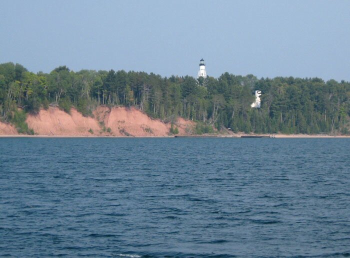 1 |
 2 |
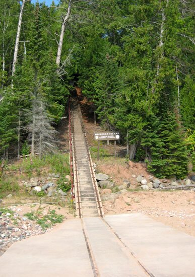
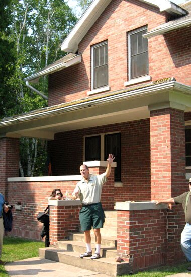
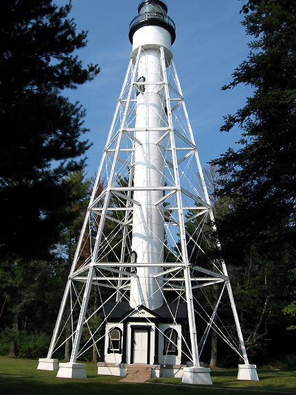
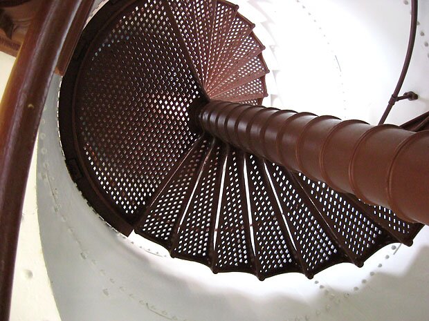
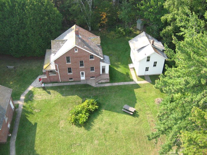
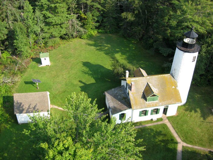
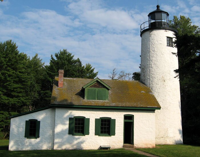
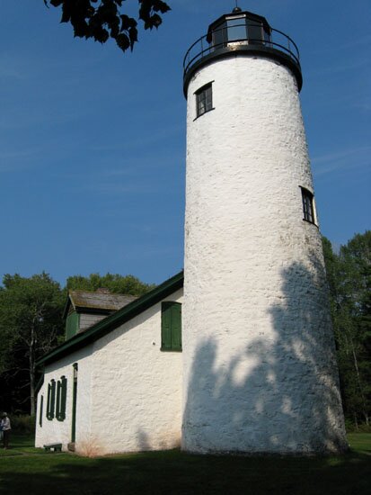
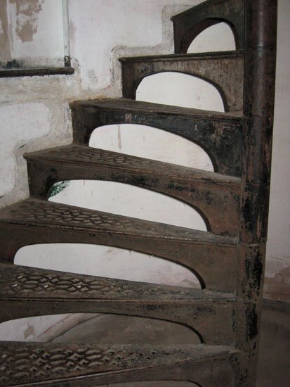
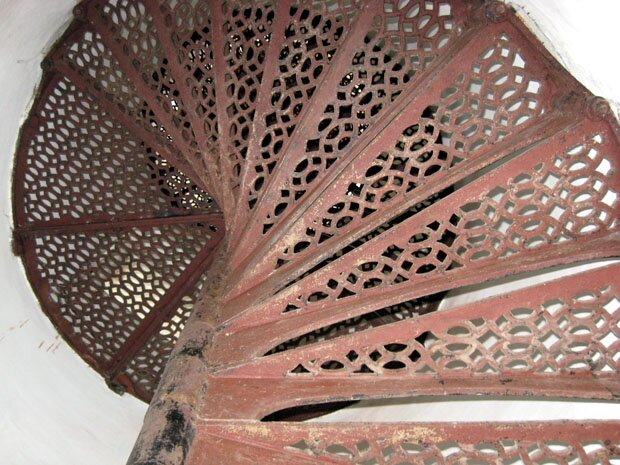
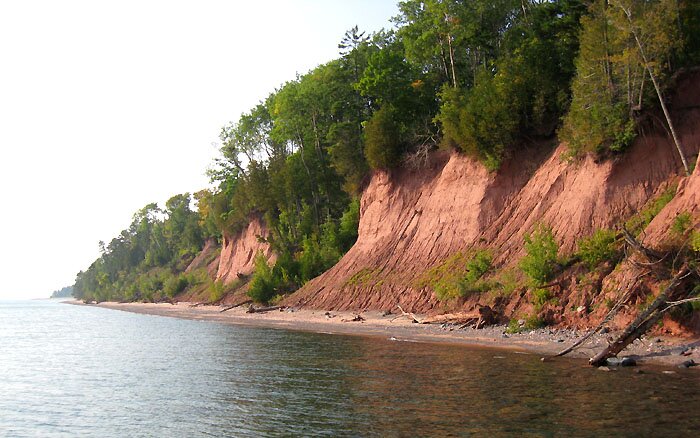
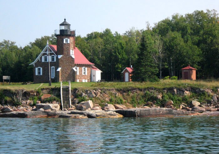
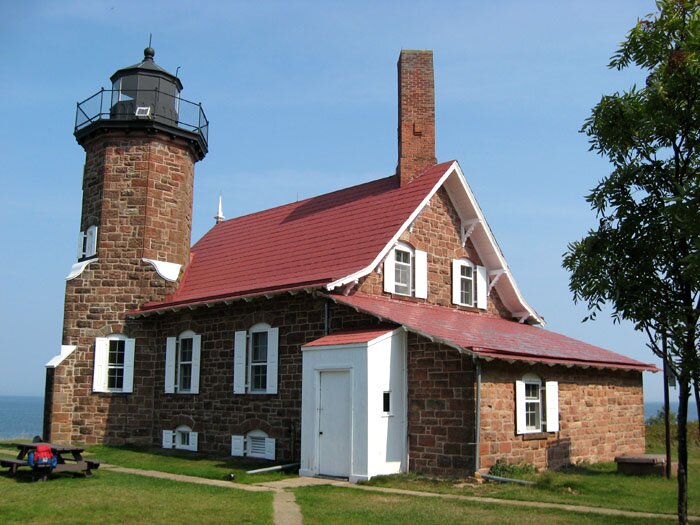
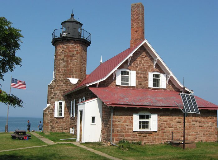
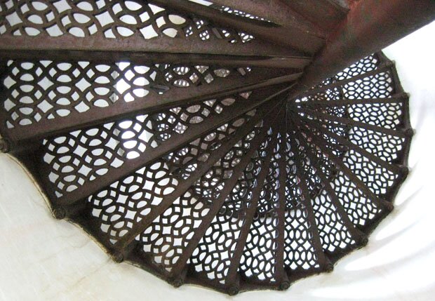
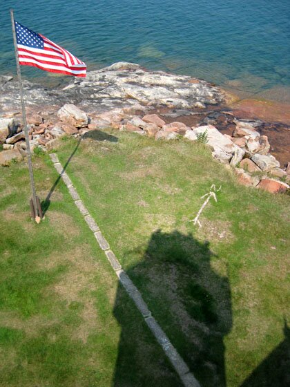
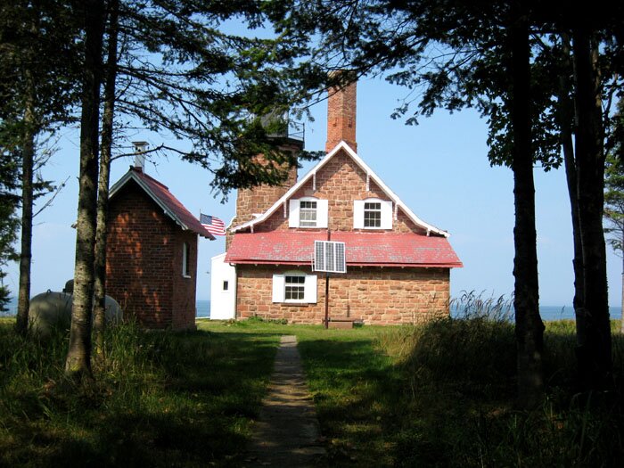
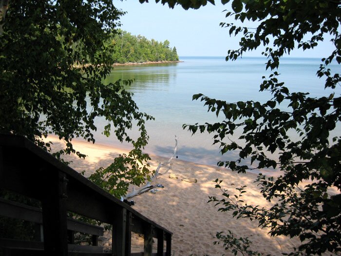
On the last two days of the 2009 Apostle Islands Lighthouse Celebration, excursions to Michigan Island and Sand Island were made on September 11 and 12, respectively. 1: The view from offshore of both Michigan Island lighthouses. The older tower is shown peeking through the trees here. 2: As on Raspberry and Outer Islands, a tramway was built along the steps to haul things up the steep slope from the dock. A view from above is shown here, and the rails continue along the grounds as seen here. 3: Our guide gives us an introduction outside the main keeper's house. Filled with information and good humor, he made our visit educational beyond expectations. 4: Originally built in 1880 at Schooner Ledge on the Delaware River in Pennsylvania, Michigan Island's newer lighthouse tower was re-installed here in 1929. Additional views are shown here, here and here. 5: A view from below of the spiral staircase. The inner wall of the tower is on our right as we ascend the stairs. 6-7: Once outside we can look down on the main house and the older lighthouse. And we can view the woods along the shore to the northeast and then a little more toward the north where we can also note the shadow of the tower in the nearby trees. In the latter view, I spotted what looked like an artificial structure and speculated that it might be the Gull Island light which is off the northeast tip of Michigan Island; a telephoto view is shown here. However, a good pair of binoculars lent by a fellow tour participant revealed it to be a dead tree and probably not in the precise direction of Gull Island anyway. Continuing our promenade around the top of the tower, we see Madeline Island to the southwest and then, looking town, an osprey nest on the tower itself. 8-9: Making the newer tower look positively modern (if not futuristic), an examination of the older lighthouse is also on our itinerary although visitors can no longer go up into the tower. Another outside view is shown here. 10-11: These are the steps leading up to the top. In the view from below (Photo 11), we see the stairs spiral upward in the opposite direction of those of the newer tower, with the inner wall being on the left as one would ascend. 12: All too soon our time is up. Here is a parting shot of Michigan Island showing the bluffs along the shore near the lighthouse dock. 13-15: On the following day, it's off to Sand Island! Here are three views of the lighthouse at the northernmost tip of the island. Built in 1881 of the finest Apostle Islands brownstone, it certainly contrasts with the relatively monolithic aspect of its sibling lighthouses.
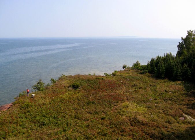
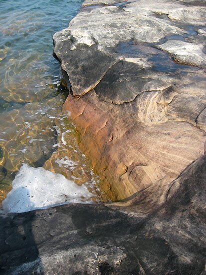
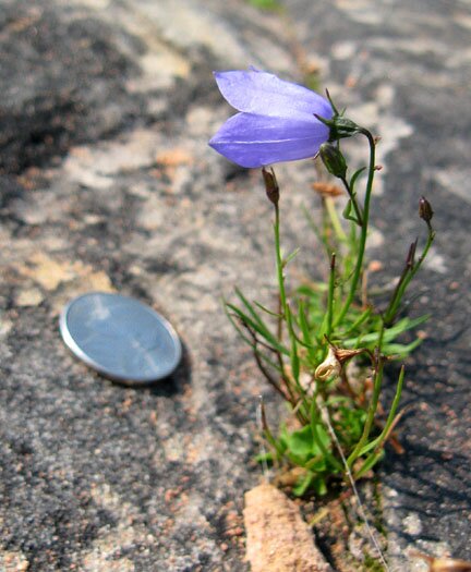
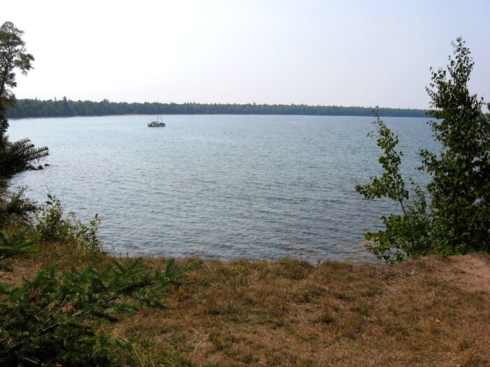
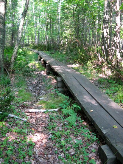
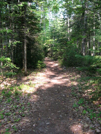
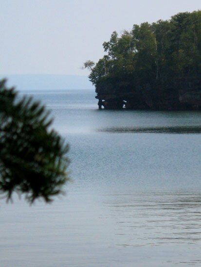
16: The stairs to the top as seen from below. As we spiral upward, the inner wall of the tower is to our left as one also sees for the older Michigan tower (above, photo 11) and the Outer Island tower seen here. There are times when a photo showing this perspective makes it difficult to visualize how a stair-climber is rotating and where would be one's right or left shoe, but it can be fun to construct scenarios that prove the not-so-obvious and cause one to wonder why one had to think so overly hard about it in the first place. 17: From the top we can see the sidewalk leading to the stairs which go down the very steep bluff to the rocky shoreline. (A view up from the shore is shown here.) 18: Looking toward the east we can see the characteristic profile of Bear Island in the distance. In this view (a little bit more toward the northeast) we would be able to have a clear shot of Devil's Island and also the empty horizon of Lake Superior if on a less hazy day. This is a view toward the north, showing the rocky shore and the underwater ledge beyond the bluff. 19: A close view of the convoluted rock formation at the water's edge. 20: This bell-shaped flower looks like a species of Campanula although I haven't fully explored the possibilities yet. The nearby nickel might show some indication of the size of this plant which is finding its nutrients wedged between the rocks near the shore. 21: Here's a parting shot of the lighthouse as we head back to our boat docked at the East Bay, two miles to the south. So, it's off the sidewalk and onto the path into the woods, expecting to have a closer look at things we might have glanced at on the way up. 22: This is Lighthouse Bay, looking toward the southwest. Then the path takes us across to the other side of the northern tip and then along the eastern side of the island. 23: Here is an interesting dome-shaped mound of mossy vegetation along the path. Not anchored to the ground, we can tilt it sideways as shown here. 24-25: Here are a couple views of the path. It is so well-maintained one could walk the two miles between East Bay and the lighthouse in one's Sunday best. (Tennis shoes are recommended, though.) The intermittant boardwalk would be especially handy in wetter times. Presently the whole area has been in a prolonged dry spell. The gullies we frequently pass over give some indication of the drainage that would probably be active and prolonged in the spring. 26-27: About half-way between the lighthouse and the East Bay dock is Justice Bay. Nearby are some sea caves along the shore which are shown here. 28: Our very knowledgeable guides we hope to see again. 29: Near the dock are signs of the community of fishermen and farmers that populated the island in the late 19th/early 20th centuries.
|
|
 3 |
 4 |
||
 5 |
 6 |
||
 7 |
 8 |
||
 9 |
 10 |
||
 11 |
 12 |
||
 13 |
 14 |
||
 15 |
 16 |
||
 17 |
 18 |
||
 19 |
 20 |
||
 21 |
 22 |
||
 23 |
 24 |
||
 25 |
 26 |
||
 27 |
 28 |
||
 29 |
|
" More Apostle Islands photos: |
This page is best viewed at 800X600 or wider. All photos on these pages are by myself unless noted otherwise. This page was last modified on 9/28/11 at 1:15 PM, CDT. John Lindquist: homepage, complete site outline. University of Wisconsin – Madison |
|
|
Spaces inserted into email address to discourage spambots. Please remove before using. |
||