|
John L's Old Maps / Supplementary Pages: Photos of the
|
|
|
|
As on Page One, background information and references relevant to this page (including Nicollet's Journals and Report) are given in the literature review. Again note that the general direction of the streams and springs is from south to north, with the Mississippi River exiting Lake Itasca at its north end. |
||
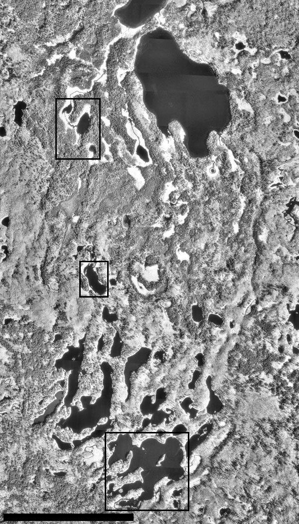
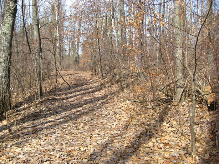
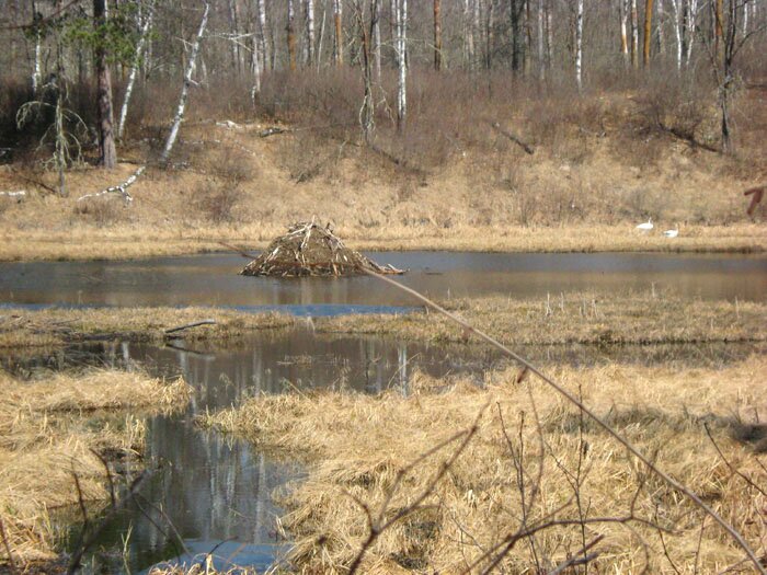
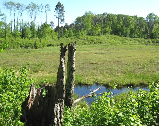
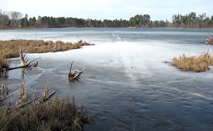
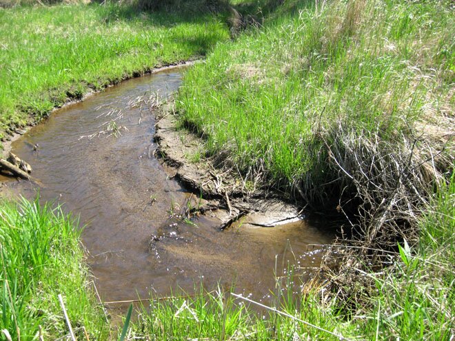
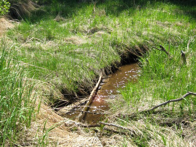
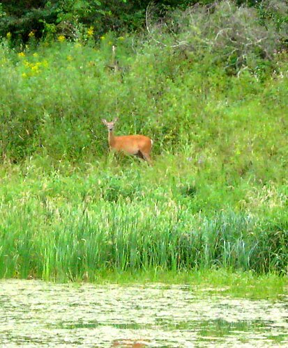
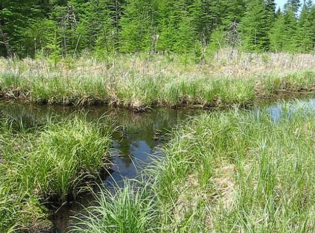
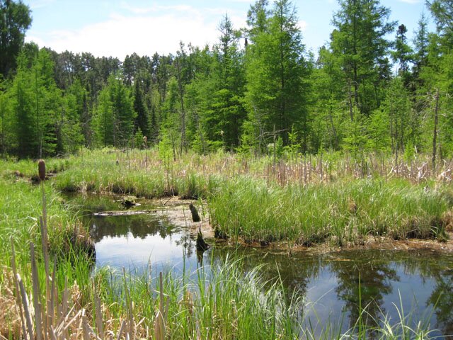
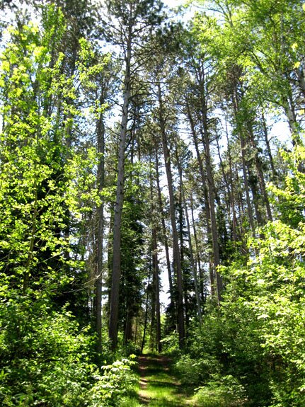
The aerial photo on the right encompasses the area between the southwest arm of Lake Itasca and the southern boundary of Itasca State Park, expanding on that which is shown on Page One which features "Nicollet's Three Lakes" – represented here by the upper rectangle. To the right of the upper rectangle is Elk Lake which occupies most of a square mile. The middle rectangle shows the main body of Whipple Lake which actually extends a bit more toward the north and west and empties into Floating Moss Lake through a colossal beaver dam (more on Page Three). The bottom rectangle is filled with Hernando de Soto Lake which is near the upper limit of the basin whose lakes, ponds, swamps, streams and springs all drain northward in the direction of Lake Itasca from which flows the Mississippi River. Hernando de Soto LakePhoto 1: The trail into the park from the south. Photos 2 and 3: The trail passes a couple swampy ponds at the upper edge of the Mississippi watershed, each possessing the requisite beaver or muskrat lodge. One can also expect a pair of swans to show up and stay for the summer in many of the park's ponds and lakes. Just over the ridge in Photo 3 is Hernando de Soto Lake which possibly receives seepage from this pond. A correction made June 28, 2010: I had been stating that these two ponds are probably the two seen in the southeast corner of the bottom rectangle on the aerial photo. However, upon better examination of the aerial photo and a corresponding topographical map, these ponds correspond to a couple swampy areas roughly to the east – just outside the border of the bottom half of the rectangle. The trail is seen to closely follow the entire eastern border of the rectangle. Photo 4: Here is the edge of Hernando de Soto Lake (swollen beyond its appearance on the aerial photo) along the ridge whose other side was seen in Photo 3. Photos 5-7: Three views of Hernando de Soto Lake in the early spring while standing at the far southeast "bulge" of the lake. Roughly speaking, we are looking (in turn) toward the southwest, the northwest and the north. The movie (click on no. 8) likewise pans this area and then continues along a bay of the lake toward the northeast and then around to the ridge noted above. It would appear from maps and the aerial photo that the "bay" is not technically part of the lake, but it is apparently part of the continuous, flooded area during times of high water (such as throughout this spring) which also inundates the trail to the high ground seen in the upper left part of Photo 7. Photo 9: Brower Island can be seen stretching across the photo. In the early spring, I found it very difficult to distinguish this island from the opposite shore.
|
|||||||||||||

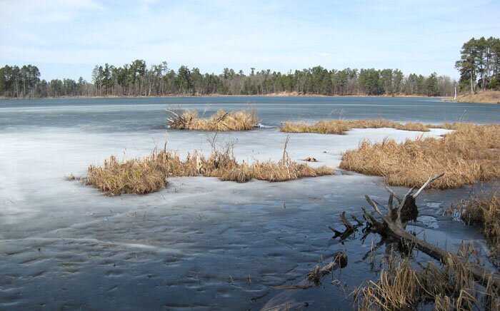

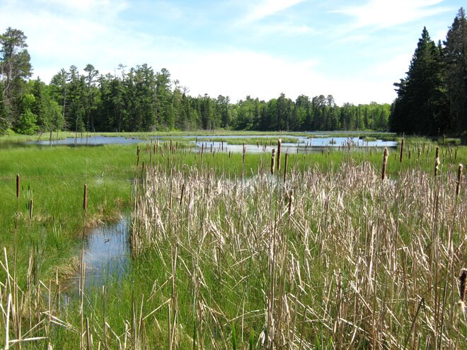
Whipple Lake
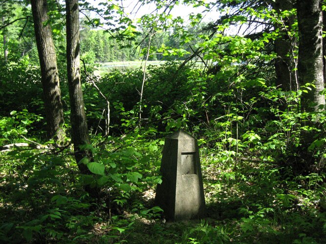
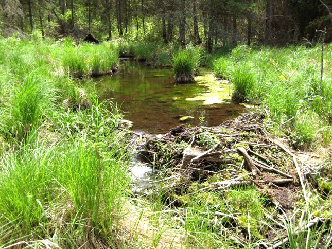
Whipple Lake's outlet flows into Floating Moss Lake from which the water runs and/or seeps into the nearby Mississippi Springs. From there, a perennial stream runs north toward Lake Itasca and would connect with Itasca as a continuous surface channel but for a major disconnect about midway – the subject of the next section of this page. Saving a more detailed visit to the Whipple Lake/Mississippi Springs area until later (see Page Three), I took a few cursory photos on this visit (late May, 2010) including Photo 10 which shows a general view of Whipple Lake from the Nicollet Trail. An old marker that has lost its plaque is seen in Photo 11. |
"Nicollet's Lakes" Revisited
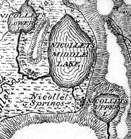
As in the aerial photo of the same area shown in Page One, the map on the right is marked up to show the Nicollet Trail (the line of red dots) and several other features referred to from the discussion of the photos below. This is a part of what is probably the most detailed map of the general area that Brower came up with from his thorough observations circa 1890, and a poster-sized copy (dated 1892) is on display at the J. V. Brower Visitor Center at the park. Brower's separate map showing the upper and middle lakes in his 1893 reference is reproduced here. Even though Nicollet did not consider these lakes to be his upper, middle and lower lakes (as he followed the course of his "infant Mississippi" in 1836 as it flows from south to north), they were at least named by Brower as a tribute to him and are referred to as such in these web pages for convenience. That which Brower labels the "Middle Lake" corresponds to Nicollet's third and last lake which Nicollet describes in his Report as "somewhat larger than the two preceding." This lake is simply designated Nicollet Lake at the park and on all of the modern maps. Some related items:
|
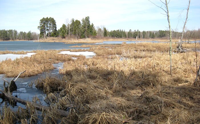
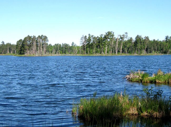
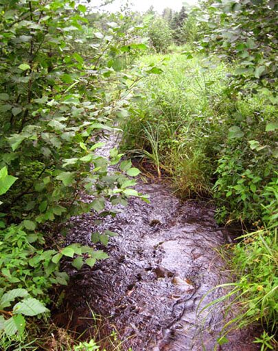
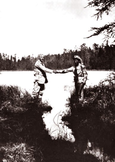
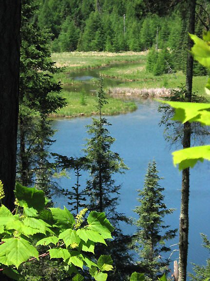
The area around the orange dot (see map above): Photo 13 (taken in August, 2009) looks downstream as the creek from Mississippi Springs emerges out of the woods. As Brower had referred to that stream on his various maps as a "detached upper fork" of Nicollet Creek (and even of the Mississippi River!), perhaps we would do well to refer to it as "Upper Nicollet Creek." The open area in Photo 14 (another view is here) appears to have been a swamp and is presently dry and easy to walk through. The hillocks are found to be the overgrown remains of old beaver dams, and the area is full of meandering stream beds. As the present course of the stream runs through this area, it has exchanged its rocky bottom for sand and mud, and it is shown in Photos 15 and 16 flowing through an old, broken beaver dam as it continues to twist and turn on its way to the "Upper Lake." This part of the stream corresponds to Nicollet's description in his Report: ". . . a cradled Hercules, giving promise of the strength of [the Mississippi River's] maturity; for its velocity has increased; it transports the smaller branches of trees; it begins to form sand bars; its bends are more decided, until it subsides again" ultimately into Nicollet Lake. (See the Journal and Report with an interpretation here.) The site of the yellow dot is at the foot of a line of hills that line the west and north sides of the "Upper Lake," and Photo 17 is a view across the pond toward the east from that spot. The "Upper Lake" rests in somewhat of a basin that is noticeably at a higher level than that of the "Middle Lake." Brower's map of that area (the one which is reproduced here) specifies a narrow ridge that precludes an open water connection between the upper and middle lakes. This ridge is not to be confused with "Brower's Ridge" which was named by Coues (see his reference) for the elevated ridge along the east side of the Nicollet Creek valley which afforded relatively easy walking through the area. Here we look northward and get an idea of the pond's edge, and Photo 17A (taken in August, 2009) looks directly at the bank at the northwest corner and shows some scale to the lower part of the ridge. In the general area of the green dot: Here we are over the hill from the "Upper Lake" and it is difficult to imagine how an outlet from that pond can penetrate the area except to flow underground, as the pond has indeed been seen to be bordered by the ridge except at its southern inlet. As we descend lower toward the "Middle Lake," the vegetation is saturated with water emerging from the ground (Photo 18) which becomes increasingly wet and muddy. Small brooklets (Photo 19 and also here) form from the springs and continue to be fed by them all along their courses. They merge as seen here and generally suggest a miniature river system. Brower's maps (the one shown above and that which is shown here) illustrate several streams arising from the hillside and merging into one channel, and a present view of that channel is shown in Photo 20 being backed up by a functioning beaver dam. We are now in the wetland which borders the southern edge of the "Middle Lake" and within which one sees the name "Nicollet Springs" applied in various maps. Brower's map (shown above) shows a Nicollet Springs channel coming from the south (Photo 22) and merging with the one from the east which we have been following, and such is indeed the case this day as seen in Photo 21. The composite stream enters the "Middle Lake" as shown in Photo 23. Photo 24 – labeled "Shaking Hands across the Mississippi" in Brower's 1904 reference (page 130) – shows two unidentified gentlemen doing so while standing at the mouth of the stream. Straddling that inlet may have been difficult, and it would be certainly impossible today. Amendatory notes inserted April 13 and May 23, 2012: The map by Brower shown above has been implying to me that the southern channel is the Nicollet Springs channel because of the position of the label "Nicollet Springs" which I have probably been taking too literally and therefore too limiting. His other aforementioned map – the one which is shown here – directly labels the eastern channel as arising from "Nicollet's Flowing Springs." It is probably the case that the source of both channels (and therefore Nicollet Springs in general) originates from the nearby "Upper Lake." This goes along well with observations made in April, 2012; see Page Five. Near the blue dot: From a steep hillside (Photo 25) adjacent to the "Middle Lake," a noisy little stream pops out of the ground (Photo 26) and grows in size as it merges with others like it and runs into the lake. Such probably occurs throughout this area and elsewhere in the park and beyond. At the brown dot: Nicollet Creek runs out of the "Middle Lake" on its way to Lake Itasca as seen in a telefoto view (Photo 27, also here) from a spot across the lake, near the Nicollet Trail (Photo 28). For park visitors who pass by this lake (designated "Nicollet Lake" on the nearby sign) this view is a real bonus of historical and geographical significance which one does not have to descend into off-trail adventures to see. One should sooner or later realize that the geography, hydrology and history of exploration of this area are every bit as important as any of the natural features pointed out by the signs along the roads and trails. (And enough about Glazier, already.) |


|
The aerial photo is a composite of images from Microsoft Research Maps (formerly Terraserver-USA) with images courtesy of the USGS. This page is best viewed at 800X600 or wider. Unless otherwise noted, all photos herein are by myself and were taken during visits in late March (before things greened up) and late May, 2010. |
Narrative on this page was finalized on 8/18/10 at 10:15 AM, CDT with references made to Page Three. Exception: The "amendatory" paragraph in red above was added in 2012 with reference made to Page Five. |
|
Continued on |
John Lindquist: homepage, complete site outline. |