|
John L's Old Maps / Supplementary Pages: Photos of the
|
|
|
|
As on the previous pages, background information and references relevant to this page (including Nicollet's Journals and Report) are given in the literature review. Again note that the general direction of the streams and springs is from south to north, with the Mississippi River exiting Lake Itasca at its north end. |
||
|
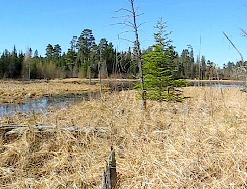
I. To review from previous pages (especially Page Two): Nicollet Lake's outlet is Nicollet Creek which, in turn, is the major inlet of Lake Itasca, flowing into Itasca from the south. Just south of Nicollet Lake is a swamp that encloses an area which is labeled on maps (to a greater or lesser extent) as "Nicollet Springs" – considered to be the "headwaters" of Nicollet Lake. Two discrete channels in the swamp collect water and then merge to form the inlet to Nicollet Lake. There would be no reason not to consider this inlet as an upstream extension of Nicollet Creek and label it as such. Brower's map of the area is very much the situation presently, and he represents Nicollet Lake as the "Middle Lake" of Nicollet. In his 1904 reference is a photo of two gentlemen on opposite sides of the aforementioned inlet, titled "Shaking Hands across the Mississippi" – reflecting the fact they are indeed at an upstream extension of the Mississippi River. The following movie still (taken from a bit farther back) shows how the inlet looks on the day of my present visit:
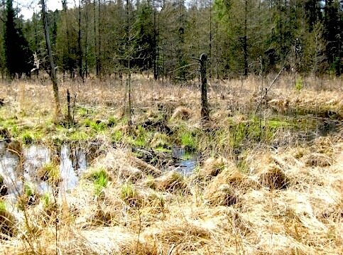
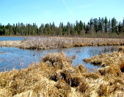
II. A photo of the swamp at the junction of the two channels follows. In taking this photo, we are looking upstream toward the south, having done about a 180 at the spot from which the above photo was taken. Note the beaver dam across the channel coming from the left (east).
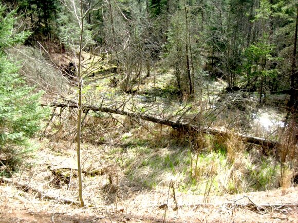
The water level was quite high at the time of my present visit, such that Nicollet Lake was backed up into the swamp. There was considerable mixing between the two incoming channels that had been separated more clearly as seen on my earlier visit (Photos 20-22) at which time I was supposing that the channel from the south was from "Nicollet Springs (per se)" and the channel from the east arose from water seeping from Brower's "Upper Lake" (of Nicollet) which is at a higher level to the southeast and has no surface outlet. On second thought, perhaps the bulk of the spring water that enters into both of these channels originates from the "Upper Lake," seeping through the intervening ridge. Then, the "Nicollet Springs" designation would be applied appropriately to the entire area of springs and channels of the wetland that abuts against the southern edge of Nicollet Lake. III. On the previous visit, I covered the area to the southeast of this swamp, noting the origin of the east channel as springs coming out of the ridge beyond which lay the Nicollet Trail and the "Upper Lake." What was made more clear this time – due to the fact that the underbrush had not yet leafed out – was a crescent-shaped indentation in the ridge from which quite a few streams were flowing. I thought of this as a natural "amphitheater" and wondered if I would find a similar situation at the famed "Crescent Springs" which is associated with the nearby Demary Creek. In his 1893 reference, Brower states, "The Crescent springs are a natural curiosity, worthy of an inspection by the adventuresome pedestrian." Here is a scene taken across the depression where the springs were collecting (toward the right) into the east channel:
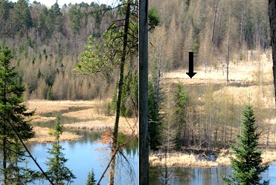
IV. Returning now to Nicollet Lake, we are looking across the lake to its outlet into Nicollet Creek. It issues from the southwest edge of the lake, not far from the inlet noted in I above. The magnified view in the photo on the right (taken from a slightly different angle) shows an arrow which points to where Howard Creek runs (left to right) into Nicollet Creek soon after the latter exits the lake. Aerial photos and maps suggest that Howard Creek may seep easterly into the lake and/or the aforementioned swamp. This adventuresome pedestrian needs to check out that spot some day (hopefully not completely falling in) and also come up with a better understanding of seepage vs. springage.
V. Here is my first glimpse of the outlet of Nicollet Creek into Lake Itasca.
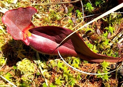
VI. Here we are at a genuine sphagnum bog in a hidden nook (or cranny) of the Park which is filled with pitcher plants. The leaves (from the previous season) have not yet revived from their overwintering state, but they should soon assume the more normal green color as seen here (Photos 5 and 6).
|
|
E-mail me at: |
Best viewed at 800X600 or wider, this page was uploaded to the |