|
John L's Old Maps / Supplementary Pages: Views of the Apostle IslandsPage XI: Stockton IslandClick on images to see |
|
 See the MENU
 |
Twice in the Summer of 2015, I took advantage of the "Stockton Island Dayhiker" program where the boat drops you off (along with campers who stay there for a more extended period) and you have (only!) two hours to hit the trails and beaches and take in the scenery of one of the larger islands at the Apostle Islands National Lakeshore. A good map to go along with this can be found here. |
|||
 1 |
 2 |
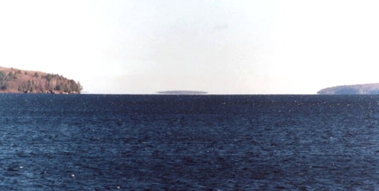
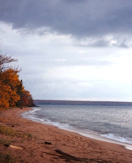
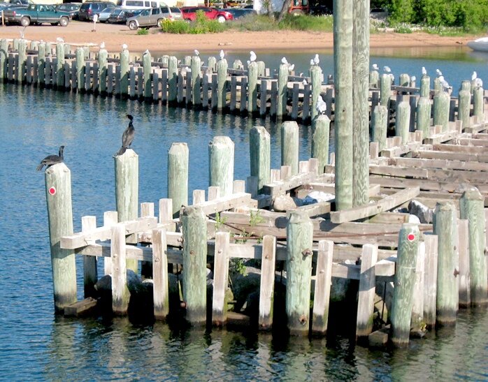
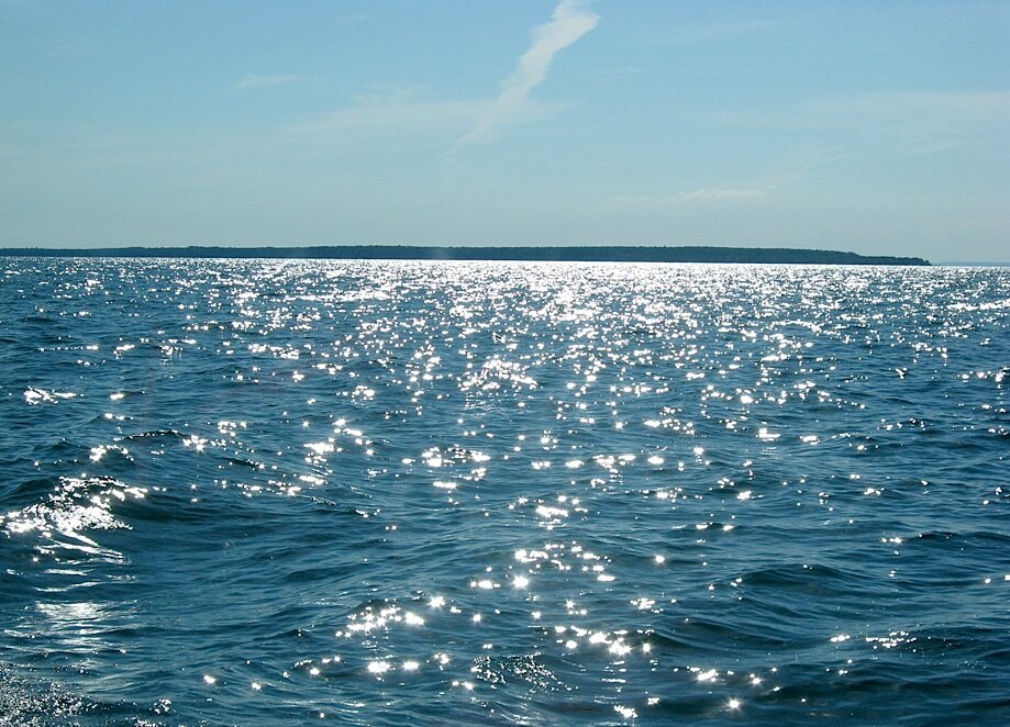
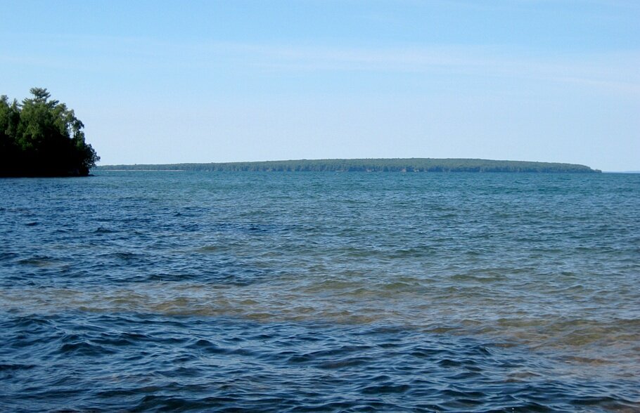
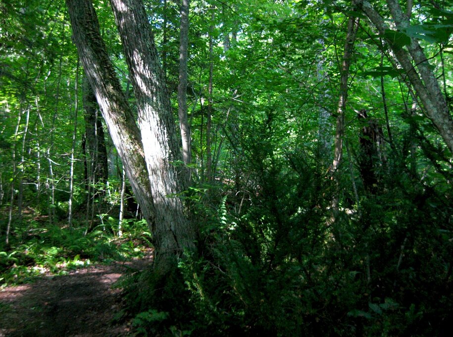
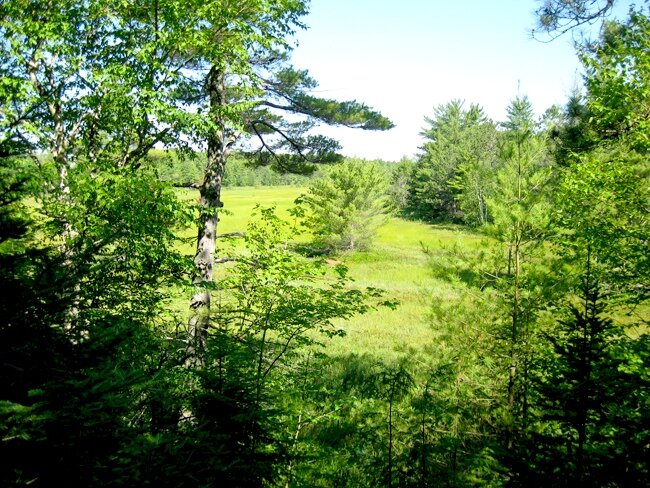
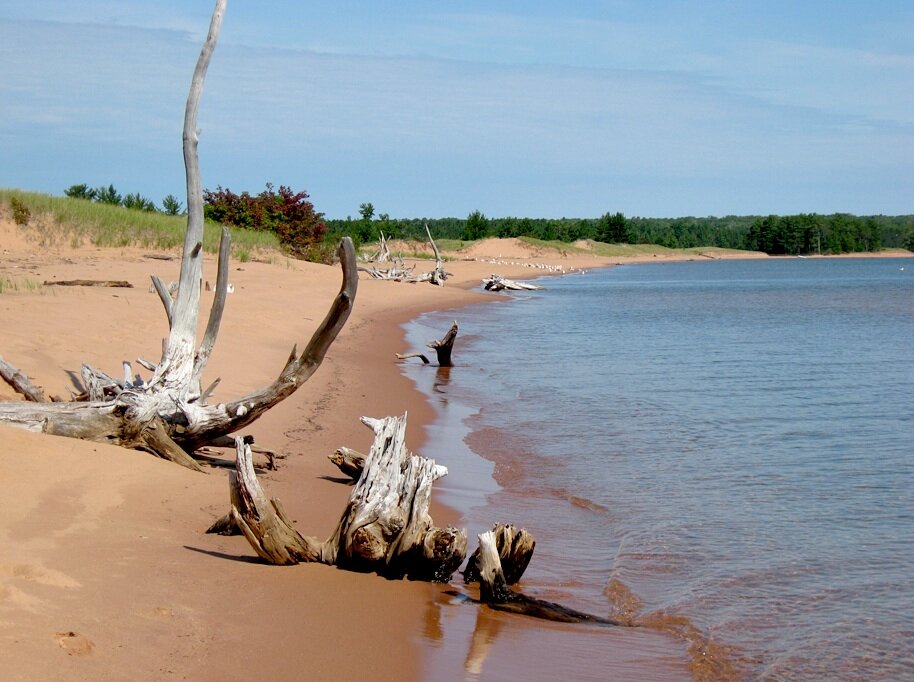
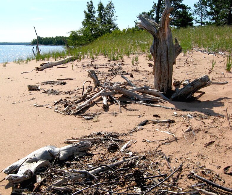
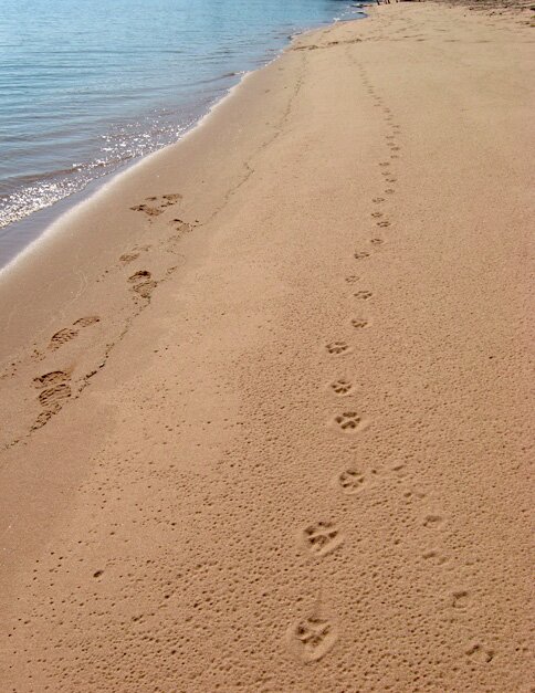
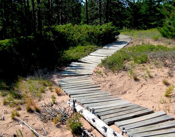
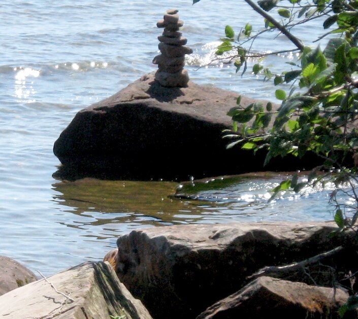
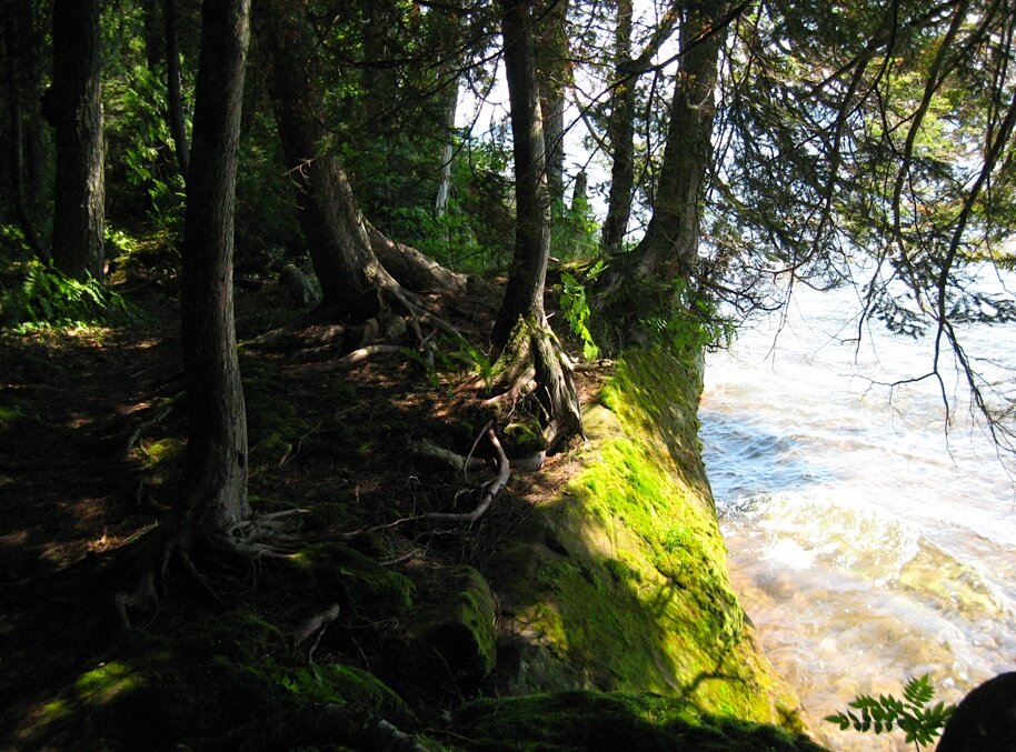
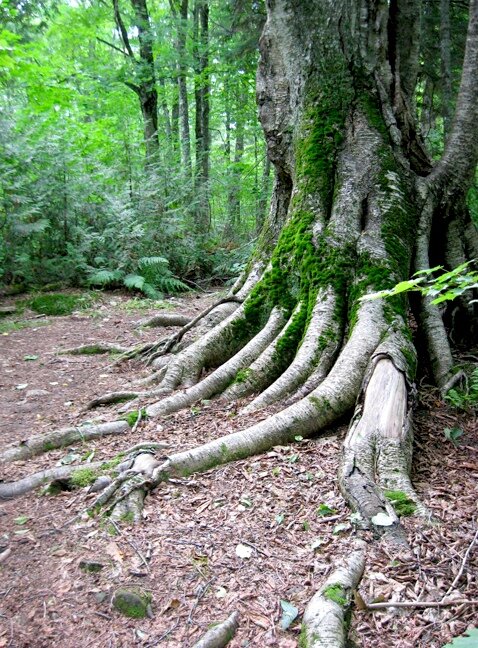
1: From the ferry which runs between Bayfield and LaPointe, Stockton Island sometimes appears as a distant mirage floating above the water between Basswood and Madeline Islands. 2: From the northeast shore of Madeline Island, we get a closer view. This photo was taken in the Fall of 2004. I would expect the fall colors on Stockton to be exceptional. 3: But we are certainly not close enough. So, we hop on the recreational shuttle in Bayfield with the usual avian gang seeing us off. 4: It only takes a little over an hour to get to Stockton Island from Bayfield. Way off to the right in the hazy distance is Outer Island, peeking around the corner. 5: Finally arriving at the dock on Stockton, we can look back and see the northeast end of Madeline Island, where we were in Photo 2. 6-8: Here are a few scenes of the Julian Bay Trail which runs across the peninsula from the dock at Presque Isle Bay to the beach at Julian Bay. This peninsula is termed a "tombolo" which is explained in reasonable detail here. A feature expected in a tombolo is a central wetland which we view running northward from the trail in Photo 8; here we see an extensive bog, and another look at the wetland is in Photo 16, below. When we get to the Anderson Point Trail (below; also see the aforementioned map), we can circumnavigate that small, formerly-separated island which became attached to Stockton Island proper via the tombolo thousands of years ago. Other places in the general area where tombolo-like formations are suggested include York, Rocky and Long Islands; Long Island has been attached to the mainland for several decades, extending the peninsula known as Chequamegon Point. Perhaps Bark Point to the west can be considered a similar situation. 9-11: Finally hitting the Julian Bay Beach and walking northward along the shoreline, we can see a variety of driftwood, including the peculiar fist-size piece in Photo 11. In Photo 9, we see a gang of seagulls in the distance. 12: It is interesting how the remaining water beads up when the waves go out. 13: Here we see some rather large kitty tracks walking along the shoreline from far to near. There are reports of bobcats on the island, so this may be one of them – possibly a female on her way to the seagulls' hang-out which we saw in Photo 9. The fourth track from the bottom of the photo looks a bit deeper than the three following tracks. It could be that the smaller tracks off to the side are from a small bobcat that the larger one had been carrying in cat-like fashion. She could be saying "Wait here, and I'll bring back some lunch." 14-15: The trails along the beach and other sandy areas include "sand ladders" which are portable and can be moved as needed. These help to keep folks from venturing too close to those very sensitive areas where plants are trying to maintain a foothold. Some cautionary advice based on experience: If the surface of the ladder is sandy and your shoes have little traction, you can easily slip and fall forward or (horrors) backward when you are not on the level. Then you are probably safer going on all fours and then buying some real hiking shoes when you get back home. 16: Inland from the beach is the bog mentioned above (Photo 8) and a small lake which extend parallel to the shoreline. Thousands of years ago in pre-tombolo days, we would be in the midst of open water between Stockton Island to the north (toward the right) and the small, separated island to the south (left) which we will shortly explore along the shore on the Anderson Point Trail. In appreciating this view, just don't tread anywhere near the grass and other plants which are trying to grow in this sandy area. 17: Hitting the Anderson Point Trail at the south end of Julian Bay Beach, we are in for an interesting hike, much of which runs along the shoreline of the formerly-separated small island. The area became known as "Presque Isle" which is French for "almost island." One may note that the entire Stockton Island is labeled "Presque Isle" on many old maps which certainly does not make sense, as Stockton has always been known historically as a true island! 18: Here we are looking back along the eastern shoreline of the Julian Bay Beach. Note the exceptionally clear water. 19: Sometimes one cannot resist constructing these from the available resources. 20: On the far southeast tip of the island, this is probably the Anderson Point which the trail is named after. We see Michigan Island, and – under the arrow – is the barely-visible Gull Island, the smallest of the Apostle Islands. With a telephoto lens, one can make out a little detail of the Gull Island Light tower which is generally passed over (as is the Little Manitou Light) in discussions about Apostle Islands lighthouses. 21: Walking roughly westward along the shoreline, we can see Madeline Island. 22-24: Some more memorable scenes from the Anderson Point Trail including evidence of black bear activity! No. 22 is my all-time Stockton Island favorite so far.
|
|
 3 |
 4 |
||
 5 |
 6 |
||
 7 |
 8 |
||
 9 |
 10 |
||
 11 |
 12 |
||
 13 |
 14 |
||
 15 |
 16 |
||
 17 |
 18 |
||
 19 |
 20 |
||
 21 |
 22 |
||
 23 |
 24 |
||
|
" More Apostle Islands photos: |
All photos on these pages are by myself unless noted otherwise. This page was last modified on 8/29/15 at 3:30 PM, CDT. John Lindquist: homepage, complete site outline. University of Wisconsin – Madison |
|
|
Spaces inserted into email address to discourage spambots. Please remove before using. |
||