|
John L's Old Maps / Supplementary Pages: Views of the Apostle IslandsPage V: Island Tours and Ferry Rides
|
|
 See the MENU
 |
The Apostle Islands Cruise Service offers a variety of scenic, narrated cruises among the islands of the Apostle Islands National Lakeshore. One can meet up with an amazing variety of sea caves, lighthouses and fellow travelers. Great views of a number of the islands can also be made during the yearly Apostle Islands Lighthouse Celebration – particularly on the Devil's Island tour. The photos shown on this page barely scratch the surface of the experience. One can also take a virtual tour of the Apostle Islands at the marlew.com site; click on "The Islands." |
|||
 1 |
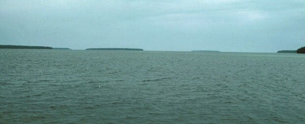
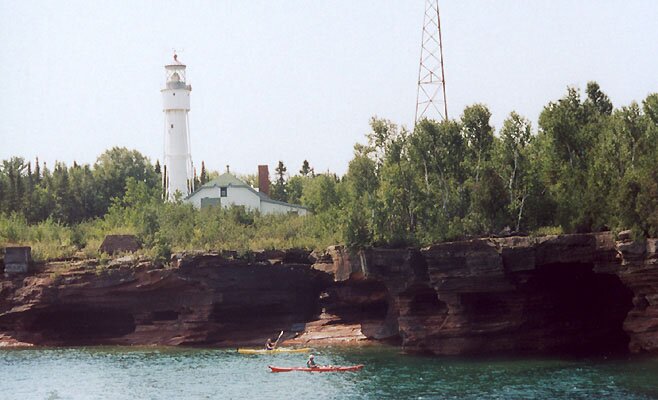
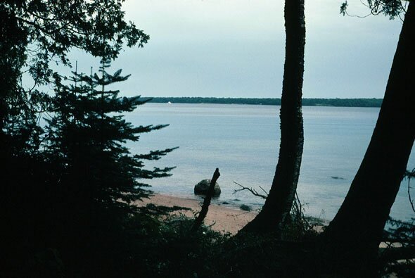
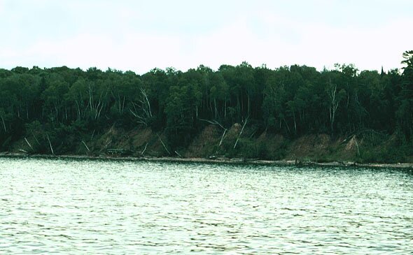
1: From a distance one may see the islands as floating pancakes. Here we have (from left to right) Otter, Rocky, South Twin, North Twin, Ironwood and Manitou Islands. 2: Definitely not looking like a pancake is Oak Island which rises 500 feet above Lake Superior which itself is only about 600 feet above sea level! That kinda puts us and Niagra Falls in perspective – don'cha think? Oak Island is the tallest of the Apostle Islands with Bear coming in second. 3–4: Coming upon Bear Island from the northwest on a September day whose weather alternated between mild/sunny and cold/rainy. Mist is rising from the various nooks and crannies of the island. A telefoto close-up is shown here. (I forget the details about this photo which may be of the mainland with a northern tip of Oak or Bear Island in the foreground.) 5–6: The Devil's Island lighthouse on the north end of the island. Photo 5 was taken in 1980 and shows the gas tank then in use to power the lighthouse which has now gone solar. Photo 6 was taken in 2006, and another modern-day view is shown here. 7: Sandstone cliffs along the east shore of Devil's Island. 8: The south end of Devil's Island. 9: What almost appeared as a city on the distant Minnesota shore turned out to be an ore carrier some miles away. 10: The Raspberry Island lighthouse which is seen here undergoing renovation in 2006. A more distant view with Bear Island in the background is here, and additional views of Raspberry Island and its lighthouse are here. 11: On Rocky Island, looking northeasterly across the water at South Twin Island. Almost looks like one of those typical tropical-island brochure scenes, doesn't it? These two islands may have been more closely associated or even connected in the recent past – as one may see on Map 13A (dated 1857) on the first maps page where they are labeled "Two Islands"; a closer view of this map is shown here. On the earlier-published version of Bayfield's map of his 1823-25 survey (discussed more on Page I), three distinct land masses are indicated, as the northeast tip of Rocky Island is significantly highlighted; see the closeup of this area on the map here. On the later-published version (1828) – detail shown here – Rocky appears intact and more closely associated with South Twin Island. 12: The "driftwood factory" along the west shore of Rocky Island. 13: Here is a hazy, distant, 1980 view of Little Manitou Island with the file cabinet-sized Little Manitou Lighthouse. (Almost looks like a stranded R2D2 from "Star Wars.") 14–15: Little Manitou Island in 2006 with its updated beacon and the usual crowd of avian admirers – generally gulls and cormorants. More about this island is below. 16: Back in the Bayfield harbor, a double-crested cormorant assumes a typical position atop the tallest pole. Also in the area, one may occasionally see groups of mergansers. The general tour of the islands features a closeup look of Lookout Point on Hermit Island whose rock bridge collapsed in 1975. Before (1970) and after (2006) photos are shown here (where you can click on Photos 12 and 13). 17: A view of Madeline Island across the frozen bay from Bayfield in March, 2006. 18–19: The car ferry makes its way between Bayfield and Madeline Island on its regular schedule throughout the year except for those times when the ice is thick enough for auto traffic or utilization of the Windsled as shown here. 20–21: La Pointe on Madeline Island as viewed from the ferry in March and October (respectively) of 2006. 22: A closer photo of La Pointe from the dock in August, 2006. 23: The Madeline Island Historical Museum. 24–25: One of the most-photographed scenes on Madeline Island: The Big Bay Lagoon which has its source in a large swamp and connects with the lake at the north end of the town park beach. As noted here, the "outlet" is frequently reversed when the seiche rolls in. Here we are facing south (toward the source), and a closer view of the islands in the middle part of the lagoon is shown here. One can imagine Henry Schoolcraft standing on this spot and pinning a name on each one. A couple more cloudy-day shots are here and here, and a view of the stairs leading down to the bridge across the lagoon (which leads to the beach) is here. 26: Cars on the dock at La Pointe awaiting the ferry. 27–29: A few shots of the ferry coming in from Bayfield. 30–34: On the return trip to Bayfield on October 28, 2006, there were some spectacular skyworks on the port side of the ferry as seen in Photos 30-32. On the starboard side we see quite a difference. Photo 33 shows the northwest side of Madeline Island, and one can pick out the four points along the shore. Photo 34 is a magnified view of Stockton Island in the distance almost appearing as a mirage. 35: Back on the mainland, here is an interesting rainbow seen a few miles west of Ashland. |
||
 2 |
 3 |
 4 |
|
 5 |
 6 |
 7 |
|
 8 |
 9 |
 10 |
|
 11 |
 12 |
 13 |
|
 14 |
 15 |
 16 |
|
 17 |
 18 |
 19 |
|
 20 |
 21 |
 22 |
|
 23 |
 24 |
 25 |
|
 26 |
 27 |
 28 |
|
 29 |
 30 |
 31 |
|
 32 |
 33 |
 34 |
|
 35 |
|||
|
More Madeline Island photos are on Pages VI, VII, VIII and XII. Some interesting things about Little Manitou Island: Early in the 20th Century, this island was apparently the length of a football field. In a 1920 study on the distribution of area mammals by H. H. T. Jackson ("An Apparent Effect of Winter Inactivity upon Distribution of Mammals," Journal of Mammalogy, Vol. 1, No. 2, pp. 58-64) it was stated: "Little Manitou Island . . . is only 300 feet long and 30 feet broad basally, narrowing to about 5 feet in width at the summit. Little Manitou Island will soon meet the fate of Steamboat Island which has entirely disappeared by action of wind and waves within the memory of man." The Coast Guard blasted away all of the soil from this small island with a high-powered fire hose several decades ago to eliminate everything that could erode away so that a solid rock base could be provided for the light which was needed to mark the end of the shoal extending from Manitou Island. Such would have also been the treatment of Steamboat Island had its rock base been similarly elevated at the end of the shoal extending from Eagle Island. However, Steamboat was totally scraped off the surface of the lake by natural forces as we read here. One could argue that the complete terraforming of Little Manitou would cause it to rank no. 1 (with Madeline as no. 2) on the list of the most "developed" of the Apostle Islands. |
|||
|
" More Apostle Islands photos: |
This page is best viewed at 640X480 or wider. All photos on these pages are by myself unless noted otherwise. This page was last modified on 9/27/11 at 8:00 PM, CDT. John Lindquist: homepage, complete site outline. University of Wisconsin – Madison |
|
|
Spaces inserted into email address to discourage spambots. Please remove before using. |
||